Site analysis: a visualisation of time in the landscape.
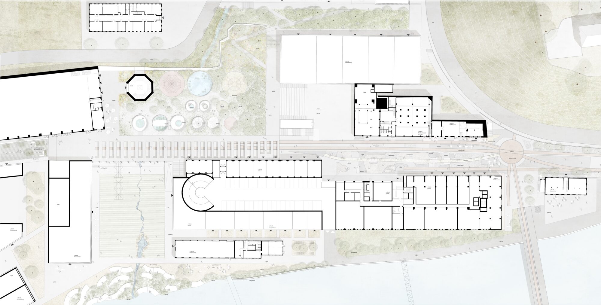
The plot is located in a scenic setting with a very distinctive character. Large extensions of forests and agricultural land make up the immediate surroundings. To the south it borders the Aare River. The current location is characterized by a topography that enjoys immediate proximity to the river, as well as views of the Alps. The density of construction on the site contrasts with the vastness of the landscape. This exciting dialogue between construction and the landscape, along with its evolution, constitutes the point of identification. The history of the site must remain identifiable. The place is like an archaeological site in the landscape, embedded between two natural formations: the river landscape of the Aare region and the green forests of the Jura.
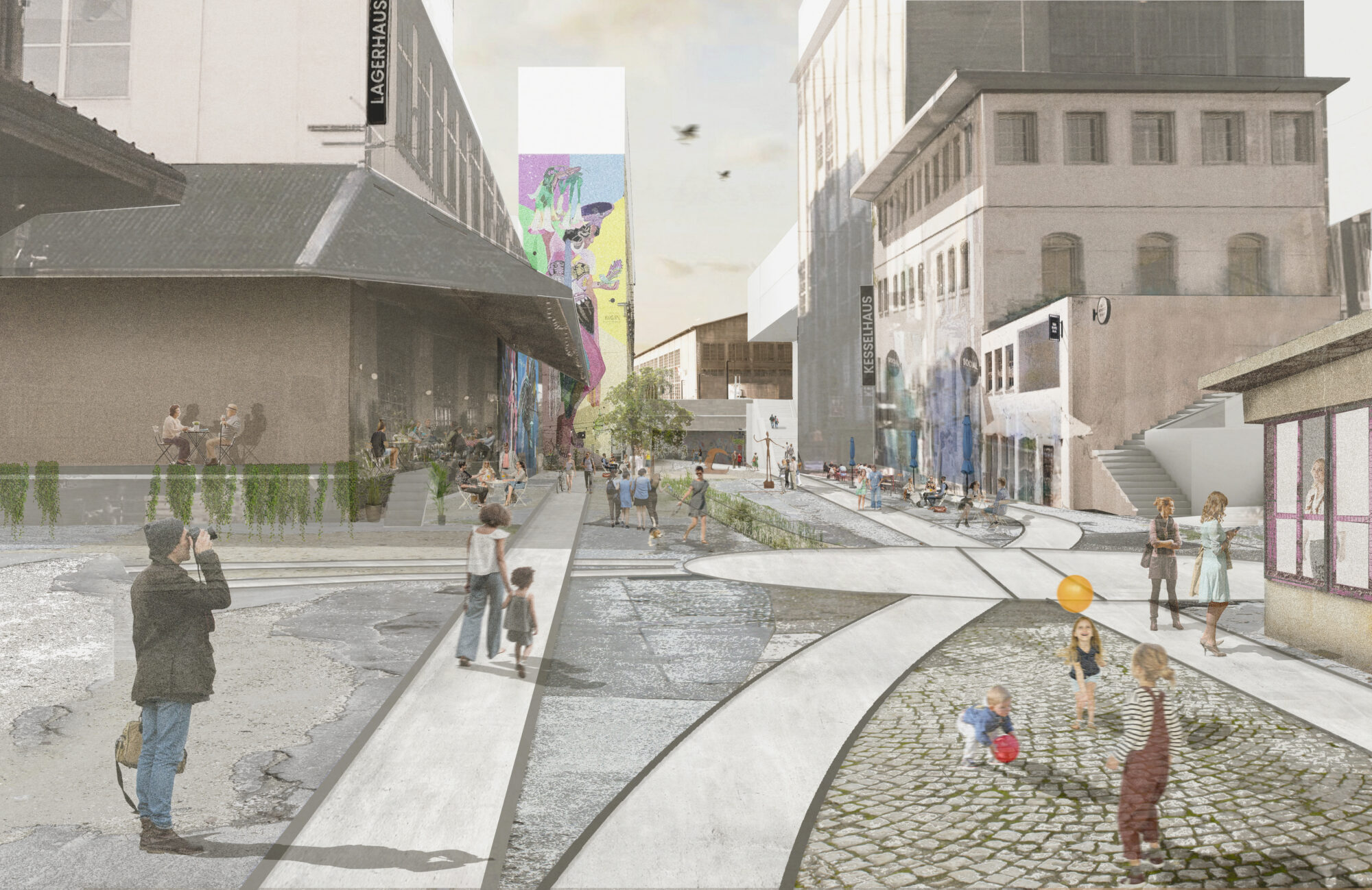
The diversity of the outdoor space characterises the place.
The Attisholz area is marked by historical transformation and industrial use in recent decades. The identity of the site is based on its industrial heritage, which is still visible and shapes the open space of the entire site in different ways. The current appearance is based on use-oriented interventions, more or less significant and of greater or lesser extent, showing different depths and intensities. Nowadays, outdoor space offers highly visited and popular activities. The mixture of different sensations and atmospheres that identifies the place is the leitmotiv for further development by creating a basic framework in which the various processes can take place and react flexibly to future uses. Large spaces for events and social exchanges interact with small interventions. Landscaping should assume different functions and be organized through a sequence of clearly defined spaces.
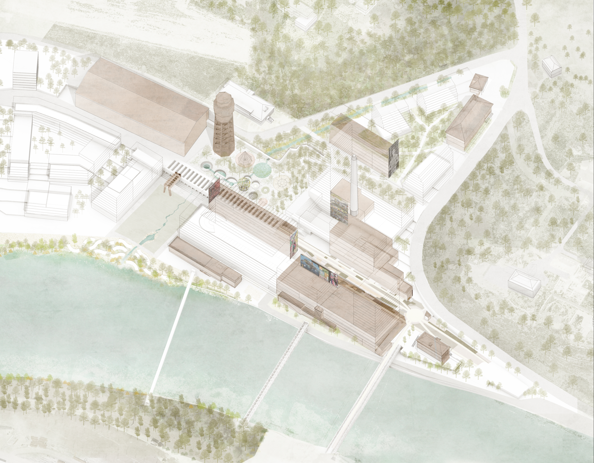
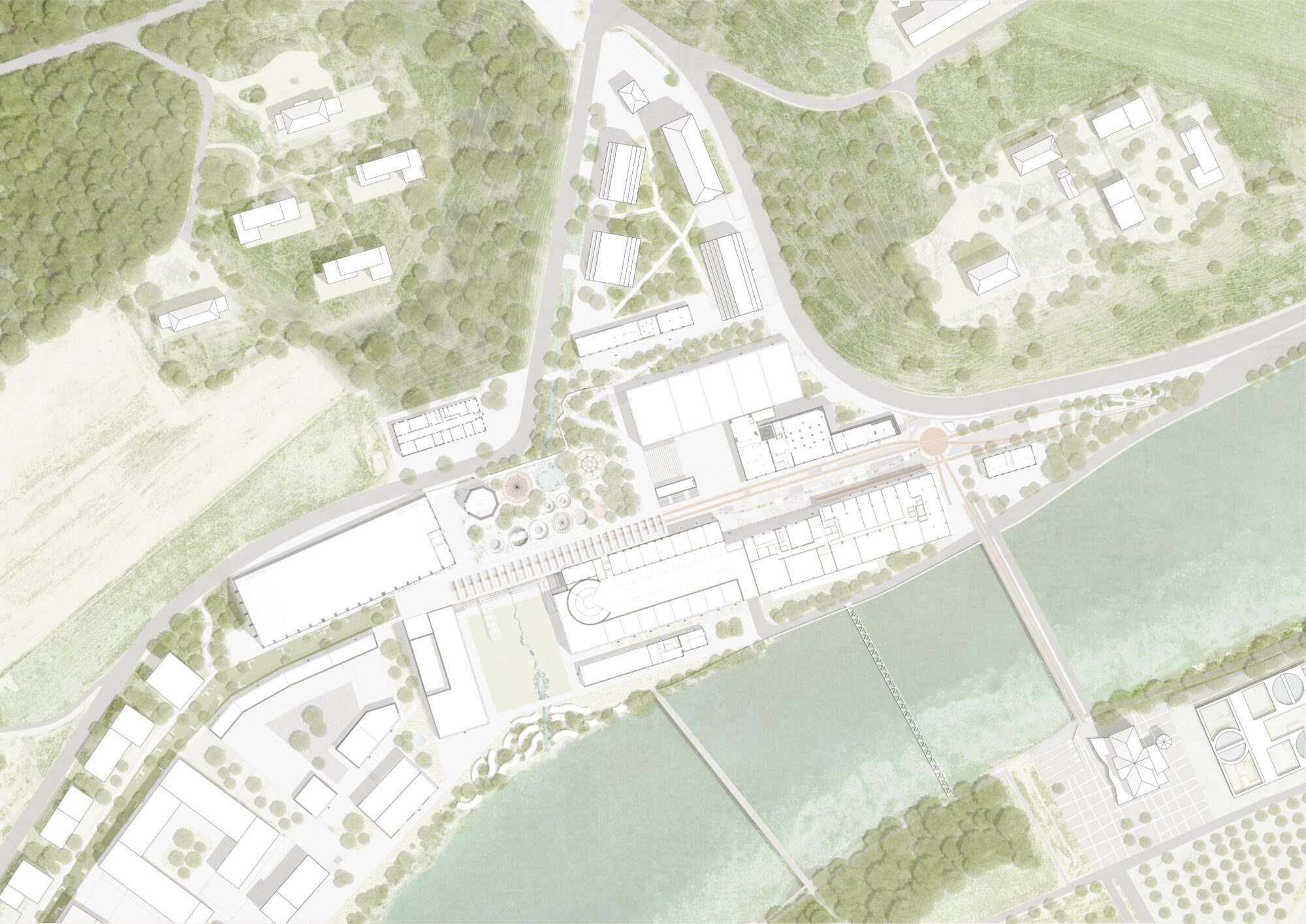
Three spaces provide structure and define the distribution of uses.
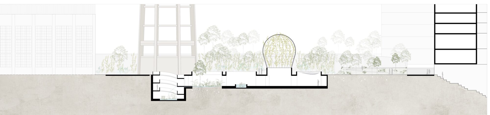
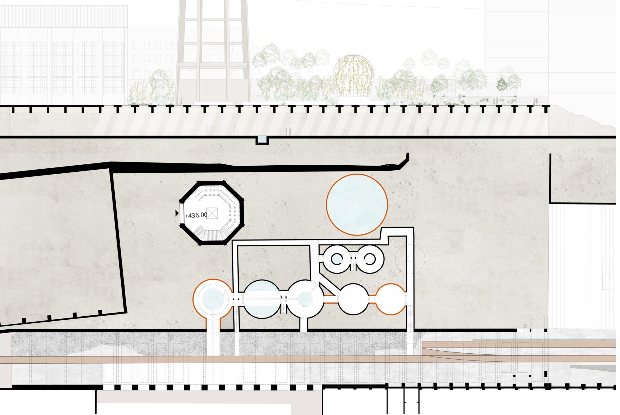
The relationship with the existing topography gives rise to the project's boundaries. Clearly, there are three spaces physically defined by retaining walls. To the north, in connection with the extensive landscape towards the adjoining forest, a sober, rich and lushly green space is created that offers space for working and entertaining. It subtly integrates the buildings into this landscape favouring the dialogue between the construction and the extension, responding to the credo that the landscape comes first. The second space is marked by the history of the site allowing you to learn more about the place in a playful way in the style of an archaeological museum. A space of didactic value with different frequencies and intensities. The existing playground is integrated and upgraded. The most depressed areas will be additionally activated and integrated into the existing structure, allowing an unobstructed connection to the Aare Square. The third space, on the banks of the Aare, focuses on being a natural space, improving the ecosystem. The Aare Square stretches between the buildings allowing the Aare River to flow visually through them. As an important pedestrian thoroughfare, the connection runs along the water. It is built on gravel-type draining pavement and the width is reduced to a minimum. A skating rink delimits the area to the west towards the visitors' parking lots.
Working with the existing: conservation through the eyes of an archaeologist.
Each place has its own history. History creates identity. Sometimes it is necessary to make room for new needs and get rid of the old. A look into the near future shows that preserving existing buildings can be a positive sign for a more sustainable approach to the environment: What has value must endure and become part of a new complex. The prospection of the archaeological site makes it possible to enhance and integrate the surviving industrial heritage. As if in an open-air museum, the curator locates legacy elements and gives them a new function. Existing structures are reinforced and brought into relationship with each other.